|
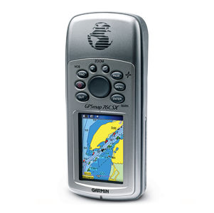
Sistemas GPS / GNSS / GIS  GPS MARINO GPSMAP 76CSx GPS MARINO GPSMAP 76CSx |
|
|
|
|
|

GPS Gamin / GPSMAP 76CSx |
 |
| Características |
|
GPSMAP 76CSx |
| Canales Receptores |
|
12 |
| |
| Antena GPS |
|
Alta Sensibilidad Quad Helix |
| |
| WAAS |
|
Sí |
| |
| SiRF |
|
Sí |
| |
| Tiempo de Adquisición |
|
15 a 45 seg |
| |
| Precisión |
|
<15m |
| |
| DGPS |
|
<3m |
| |
| Protección Ambiental |
|
IPX7 |
| |
| Tamaño (Alto / Ancho / Profundidad) |
|
15.7 x 6.9 x 3.6 cm |
| |
| Peso |
|
215 gr |
| |
| Tipo de Pantalla |
|
Color TFT |
| |
| Tamaño de Pantalla |
|
5.6 x 3.8 cm |
| |
| Batería |
|
2 AA |
| |
| Tiempo de Operación |
|
18 hrs |
| |
| Memoria y Comunicación |
|
|
| |
| Memoria Interna |
|
|
| |
| Memoria Expandible |
|
Micro SD |
| |
| USB y Serial |
|
USB / Serial |
| |
| Waypoints |
|
1000 |
| |
| Tracklog Points |
|
10000 |
| |
| Rutas / Leyendas |
|
50 / 250 |
| |
| Almacenamiento / Mapas GPS |
|
|
| |
| Mapas Base |
|
Auto enrutable, América o Atlántico |
| |
| Almacenamiento de Mapas |
|
Expandible |
| |
| Mapas Topográficos (no incluidos) |
|
MapSource Topo |
| |
| Mapas Marinos (no incluidos) |
|
MapSource Bluechart |
| |
| Funciones |
|
|
| |
| Calculo de áreas |
|
Sí |
| |
| Brújula Electrónica |
|
Sí |
| |
| Altímetro / Barómetro |
|
Sí |
| |
| Calendario |
|
--- |
| |
| Alarmas Audibles |
|
Ancla, llegada, reloj, fuera de curso |
| |
| Velocidad Vertical / Elevación |
|
Sí |
| |
| Información de Mareas |
|
Sí |
| |
| Comunicación Inalámbrica |
|
Sí |
| |
| Visor de Imágenes |
|
|
| |
| Información Celeste |
|
|
| |
Incluye:
- Equipo estándar
- Manual de operación
|
|
|